The RoadBotics Product Team continually strives to improve the performance of our platform, RoadWay. This month’s Product Updates include an upgraded–and more user-friendly–platform interface and advanced road rating analysis.
Start at Your Dashboard
Previously, when you logged in, you were taken to your assessment map. Now, RoadWay displays a dashboard-style ‘homepage’ instead of the assessment map.
The dashboard shows the previous assessments in a list or grid layout, where users can access the map and network ratings analysis for each. For Enterprise Partners, the dashboard gives them access to all of their projects under one login.
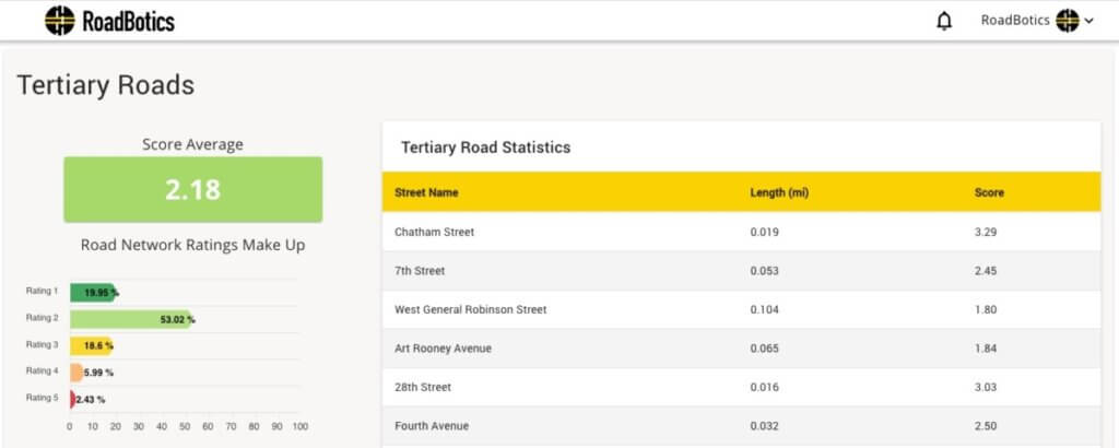
See Your Network Rating Analysis
The network ratings analysis displays the network’s score by reporting the overall average rating and the percentage of roads at individual ratings 1-5. Additionally, the analysis provides the same level of detail by road classification, for example, primary, secondary, or tertiary roads.
Add Users from Administration Page
RoadWay users now have access to an Administration page from a drop-down menu under the user name in the top-right of the platform. On this page, RoadWay administrators can add or remove users, manage permissions, and monitor a user’s status.
Enterprise partners can now manage user accounts and set roles from the Administration page. User role classifications include ‘Admin,’ ‘Member,’ and ‘Viewer.’ All levels of permission allow users to interact on the platform and access the network data analysis.
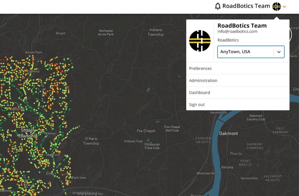
Switch Between Assessments
Previously, users with multiple assessments could switch between them from a toolbar on the left-hand side. Now, users can easily toggle between their different assessments using the “Select an assessment” option from the drop-down menu that appears when they click on their user name in the top-right corner of the platform.
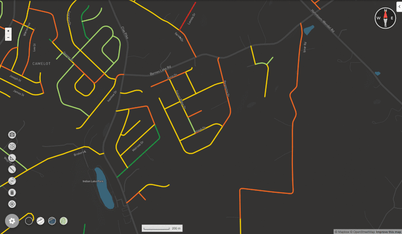
Measure and Analyze with Dynamic Segmentation
RoadWay members can use the Dynamic Segmentation tool to determine the total length of road(s) and average road rating of any area on the map by grouping individual segments together. This feature allows a user to determine the length and rating for an entire road divided into segments.
Identify Individual Distresses
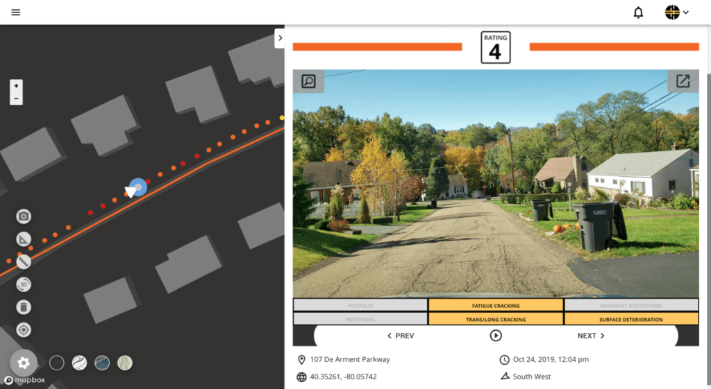
Would you like to be able to identify individual distresses in your road network? RoadWay now has a subscription option to show where potholes, surface deterioration, and fatigue cracking are happening, and we’re ready to share it with you.
Read the Press Release about Individual Distress Identification to learn more about our new capabilities. Contact your RoadBotics Specialist for more information or attend a live demo.
Want to learn more about our new capabilities? Contact your RoadBotics Specialist for more information or attend a live demo.