
SIDEWALK ACCESSIBILITY AND MOBILITY
Do you need to make sure your sidewalks, curb ramps, and crosswalks are accessible and compliant?
- Accurately Assess for Compliance
- Avoid Litigation
- Tag Issues to Address
- Ensure Citizen Safety
USE CASE

Challenge
Sidewalk Accessibility and Mobility
Reason
Towns of all sizes are required to adhere to regulations set forth by the Americans with Disabilities Act of 1990. Sidewalks, and crosswalks must meet ADA standards, have appropriate signage, and be clear of debris and tripping hazards.
Constraints
Sidewalk monitoring and maintenance requires documentation for hazards, obstructions, and upgrades. Locating these occurrences and assigning teams to repair them can be tedious and time-consuming for many miles of sidewalk.
Motivation
Digitizing your sidewalks allows you to view the entire network as a whole. High definition imagery, GPS, and tagging data can be used to identify current repair needs and locate areas of concern where other assets may cause unintended obstructions, including fire hydrants, tree pits, manhole covers, and bike racks.
Solution
AgileMapper helps you build meaningful maps and make data-driven decisions powered by artificial intelligence (AI).
Start by uploading your existing visual data in the form of smartphone photos, 360 images, GoPro footage, and drone footage to the AgileMapper desktop website. To begin collecting new visual data, you can also download the AgileMapper app and use the camera on your smartphone to capture sidewalks and images of adjacent assets.
AgileMapper’s AI quickly assigns appropriate image tags, like Pedestrian Sign, Curb Ramp, and Tree Pit, that can be later used to sort and analyze. You can also create your own set of tags based on common sidewalk issues like tripping hazards or broken slabs.
Maybe you currently have a conditional rating system for your sidewalks. Simply use that within AgileMapper and align your new data with your historical data.
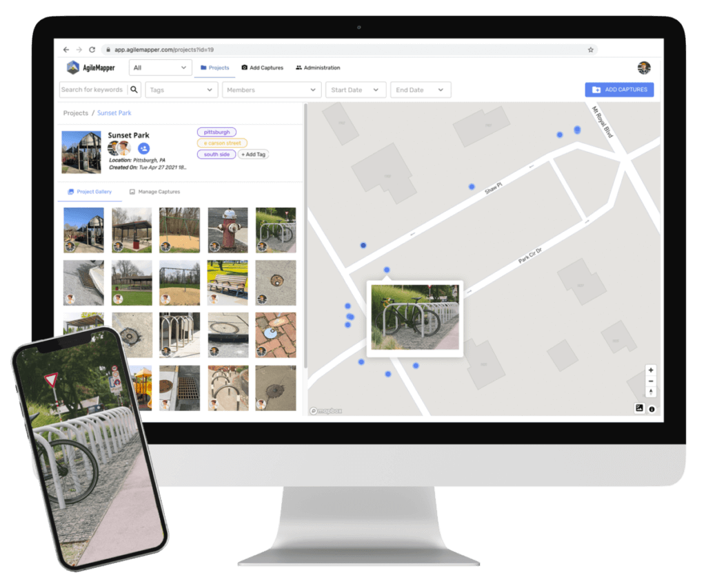
Now, your asset images, tags, and geo-spacial data are mapped on the interactive AgileMapper platform, and can be filtered or sorted by keywords, tags, users, or time frames to focus on a particular need, project, or situation.
AgileMapper can also be shared in a view-only format internally or externally to improve communication, promote accountability, and increase transparency. If you are already using a major GIS platform like QGIS or Esri, we can help with integration.

